Video Credit: ESA, Gaia, DPAC
2017-04-18
Astronomy picture of the day - 2017 April 17 - Two Million Stars on the Move
Video Credit: ESA, Gaia, DPAC
Astronomy picture of the day - 2017 April 16 - Life-Enabling Plumes above Enceladus
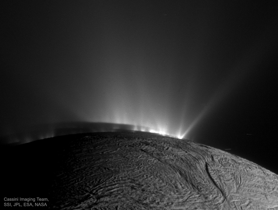
Image Credit: Cassini Imaging Team, SSI, JPL, ESA, NASA
Explanation: Does Enceladus have underground oceans that could support life? The discovery of jets spewing water vapor and ice was detected by the Saturn-orbiting Cassini spacecraft in 2005. The origin of the water feeding the jets, however, was originally unknown. Since discovery, evidence has been accumulating that Enceladus has a deep underground sea, warmed by tidal flexing. Pictured here, the textured surface of Enceladus is visible in the foreground, while rows of plumes rise from ice fractures in the distance. These jets are made more visible by the Sun angle and the encroaching shadow of night. A recent fly-through has found evidence that a plume -- and so surely the underlying sea -- is rich in molecular hydrogen, a viable food source for microbes that could potentially be living there.
2017-04-15


Astronomy picture of the day - 2017 April 15 - Luminous Salar de Uyuni
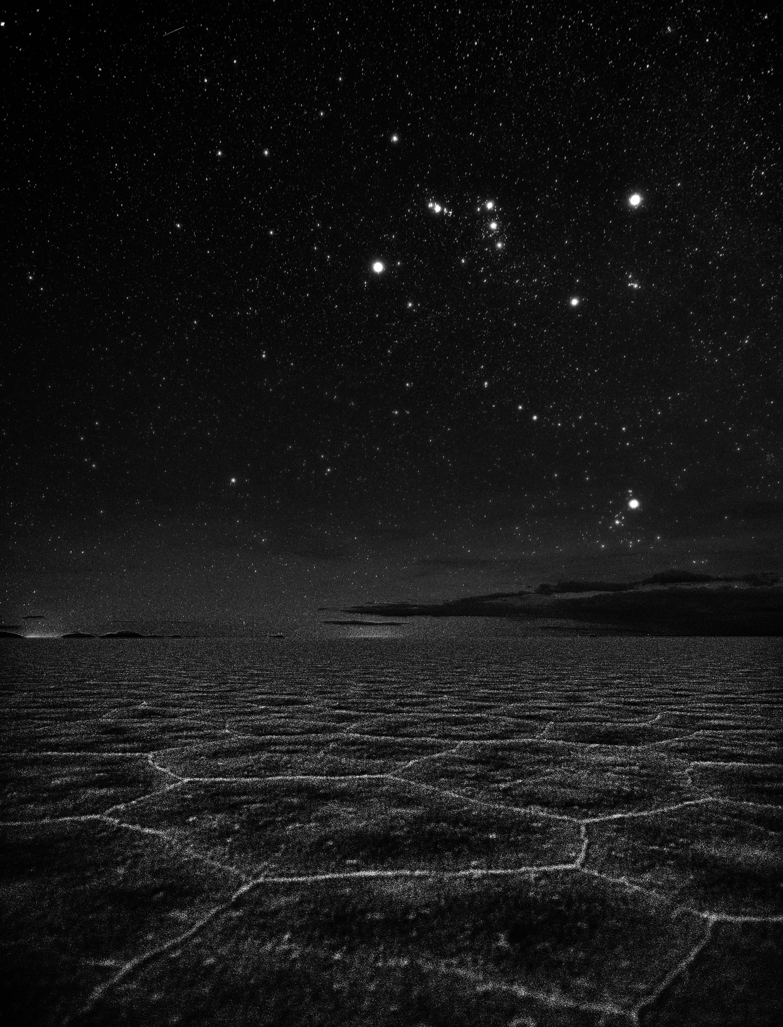
Image Credit & Copyright: Stephanie Ziyi Ye
Explanation: A scene in high contrast this thoughtful night skyscape is a modern composition inspired by M. C. Escher's lithograph Phosphorescent Sea. In it, bright familiar stars of Orion the Hunter and Aldebaran, eye of Taurus the Bull, hang in clear dark skies above a distant horizon. Below, faintly luminous edges trace an otherworldly constellation of patterns in mineral-crusted mud along the Uyuni Salt Flat of southwest Bolivia. The remains of an ancient lake, the Uyuni Salt Flat, Salar de Uyuni, is planet Earth's largest salt flat, located on the Bolivian Altiplano at an altitude of about 3,600 meters. Escher's 1933 lithograph also featured familiar stars in planet Earth's night, framing The Ploughor Big Dipper above waves breaking on a more northern shore.
2017-04-14
Astronomy picture of the day - 2017 April 14 - Earth Shadow over Damavand

Image Credit & Copyright: Majid Ghohroodi
Explanation: Through crystal clear skies this beautiful panorama follows the curve of planet Earth's shadow rising across the top of the world. The tantalizing twilight view is composed of eight single frames captured from 4,000 meters above sea level at sunset on April 6. Just above the dark grey Earth-shadow boundary lies a fading, pinkish, anti-twilight arch. Also known as the belt of Venus, its reddened and back-scattered sunlight finally merges with the still blue eastern sky. Standing tall near center along the rugged horizon line is the distant sharp peak of Mount Damavand in the snowy Alborz mountains. A feature in Persian mythology and literature, Damavand is a stratovolcano reaching 5,610 meters above sea level, the highest peak in Iran and the Middle East.

2017-04-13

Construção de Ponte 25 de Abril - Video - Documentario

Tendo começado a ser construída em 1962 e terminada em 1966, mais precisamente no dia 6 de Agosto de 1966 quando foi inaugurada, foi uma das poucas obras no nosso país desde então que foi projectada e construída, sem que houvessem derrapagens no orçamento. Foi uma obra feita há quase meio século, mas feita com pés e cabeça, note-se por exemplo que só várias décadas após a construção é que foi implementada a circulação de comboios, mas a ponte já estava preparada para isso. Se fosse actualmente mandava-se abaixo e construía-se outra…
Construção de Ponte 25 de Abril
Inscription à :
Articles (Atom)